Neon Genesis Evangelion Real Locations: Why Hakone Is Actually Tokyo-3
Most anime pilgrimage articles, including a couple of others on this site, spend a lot of words carefully separating “officially confirmed” from “fans just noticed a resemblance.” Neon Genesis Evangelion (新世紀エヴァンゲリオン, Gainax, 1995, later continued by Studio Khara) doesn’t need that disclaimer, at least not for its core setting.
In the show, the fictional city of Tokyo-3 is explicitly built inside the caldera around Hakone and Lake Ashi in Kanagawa Prefecture. This isn’t a background artist quietly copying a real street corner and hoping someone would notice years later — the geography is stated as part of the story itself. Hakone’s volcanic basin, ringed by mountains, with a lake at its center, is the real-world landform the series uses as Tokyo-3’s location. That’s a meaningfully different situation from, say, a townscape that merely “looks like” an anime backdrop and became a pilgrimage site through fan consensus after the fact.
So this guide skips the “is it really the place?” debate and goes straight to practical: what’s actually in Hakone, how to get to each spot, and what to know before you go — including one location where the honest answer is “check first, it might be closed.”
A quick note on what “confirmed” means here
To be precise about the claim: Hakone as a region and Lake Ashi’s caldera setting are the acknowledged real-world basis for Tokyo-3’s geography. That’s different from saying every specific building or shot in the anime is a 1:1 photographic match to a specific real spot — Tokyo-3 itself, with its retractable skyscrapers and NERV headquarters, is obviously fictional infrastructure layered onto that real landform. What you’re visiting here is the real landscape the story is built on top of, not a set of literal filming locations in the way a live-action production would leave behind. That’s still a much stronger connection than most pilgrimage sites get.
Owakudani (大涌谷) — the volcanic valley Official
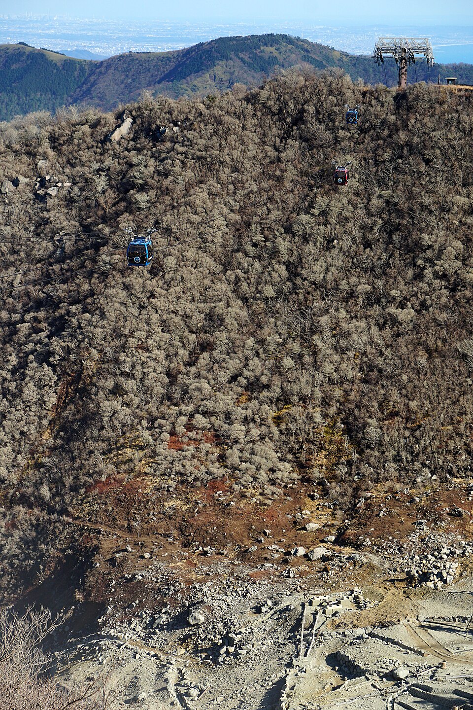 Photo: 663highland, via Wikimedia Commons (CC BY 2.5). Source.

What it is: An active volcanic valley near the summit of Mt. Hakone, formed by a phreatic eruption roughly 3,000 years ago. Sulfurous steam vents, bubbling ground, and the smell of sulfur are all still very much active features, not tourist set-dressing. This kind of raw, jagged volcanic terrain sitting inside the same caldera as Lake Ashi is part of what makes the Tokyo-3 setting distinctive.
Coordinates: 35.241861, 139.020806
How to get there: Take the Hakone Tozan Bus or the Hakone Ropeway to Owakudani Station. From Hakone-Yumoto Station, budget roughly 40–50 minutes total, since the trip typically involves a bus-to-ropeway (or train-to-ropeway) connection rather than a single direct ride.
Important — read before you go: Owakudani is an active volcanic area with real, current access restrictions. Japan’s volcanic alert level system can raise restrictions or close parts of the area on short notice when gas activity increases — this has happened before and will happen again. Before you travel, check the current volcanic alert status and Hakone Ropeway operational status, since a partial closure can mean the ropeway simply doesn’t run to Owakudani that day.
Etiquette and safety:
- Stay on the designated boardwalk at all times — this isn’t a “recommended” path, it’s the boundary between the safe visitor area and an active hazard zone
- No smoking or open flame near the vents
- Don’t linger in one spot along narrow sections of the boardwalk if it’s crowded — sulfur gas concentration and footing both matter more here than at a typical scenic overlook
- If you have respiratory sensitivities, be aware the sulfur smell is strong and unavoidable at close range
Hakone-Yumoto Station (箱根湯本駅) — the gateway Official
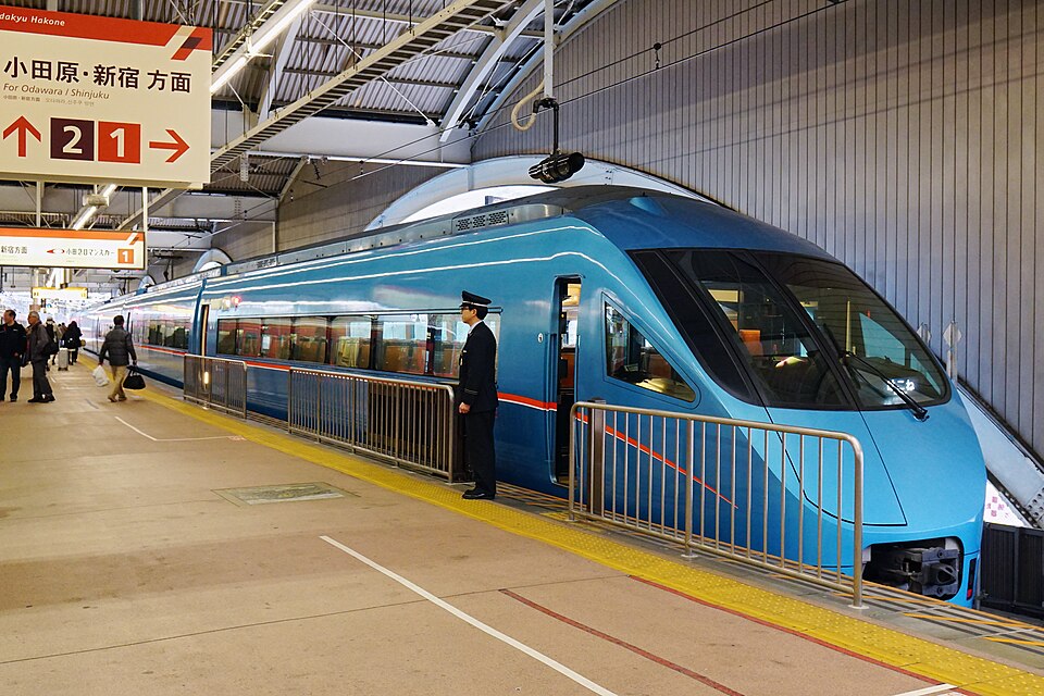 Photo: 663highland, via Wikimedia Commons (CC BY 2.5). Source.

What it is: The main entry point into the Hakone area, served by both the Hakone Tozan Railway and the Odakyu Line. For most visitors coming from Tokyo, this is where a Hakone day trip or overnight stay actually begins — you change trains or pick up a bus pass here before heading further into the mountains toward Owakudani or Lake Ashi.
Coordinates: 35.233333, 139.103528
How to get there: Odakyu Line direct or limited express (Romancecar) service runs from Shinjuku, or you can connect via the Hakone Tozan Railway from Odawara if you’re coming in on the Tokaido Shinkansen.
Etiquette: Nothing unusual here beyond normal train station courtesy — but the platforms and station concourse get genuinely crowded during peak travel times (weekend mornings heading in, weekend afternoons heading out), so be mindful of foot traffic with luggage or tripods.
Hakone Shrine, Heiwa no Torii on Lake Ashi (箱根神社・平和の鳥居) Official
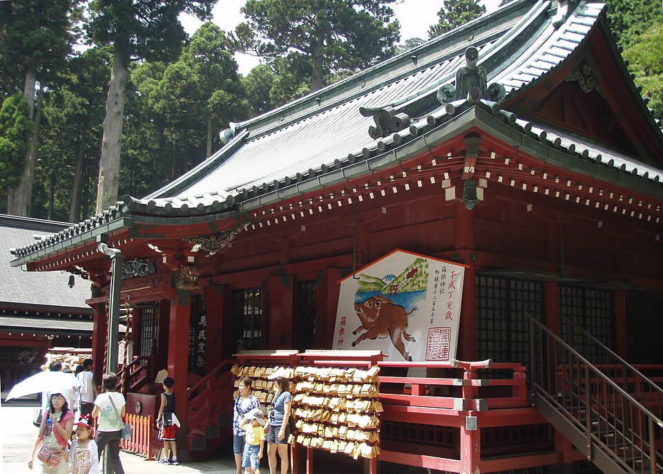 Photo: NOZO, via Wikimedia Commons (CC BY-SA 3.0). Source.

What it is: Hakone Shrine sits on the shore of Lake Ashi in Moto-Hakone, and its “Peace Gate” (平和の鳥居, Heiwa no Torii) is the vermillion torii that appears to rise directly out of the lake — one of the most photographed single images in the entire Hakone region. Lake Ashi itself, filling the caldera, is the geographic centerpiece that anchors the whole Tokyo-3 setting.
Coordinates: 35.20475, 139.025361
How to get there: From the Moto-Hakone bus stop (Hakone Tozan Bus), it’s about a 10-minute walk to the torii.
Etiquette: This spot has an actual queue system for the classic “torii standing in the lake” shot, because it is extremely popular and the good angle is narrow. Be patient, take your photo, and move on rather than holding up the line for an extended posed or staged shoot. It’s also worth remembering this is an active shrine, not just a photo backdrop — keep noise down once you’re on the shrine grounds themselves, separate from the lakeside torii area.
Suggested order for a day trip
If you’re coming from Tokyo and doing this in one day: start at Hakone-Yumoto Station in the morning, head up to Owakudani first (check the alert status before you commit to this leg), then come back down toward Lake Ashi and Hakone Shrine in the afternoon, when the light on the torii tends to be better anyway. This is a genuinely full day if you want unhurried time at all three spots rather than a rushed checklist.
(Lodging and tour affiliate links will be added here once partner programs are active.)
FAQ
Is it actually true that Hakone is Tokyo-3, or is this fan theory like most anime pilgrimage spots? It’s confirmed within the story itself, not a fan theory. Tokyo-3’s setting is explicitly built into Hakone’s real caldera and Lake Ashi geography. That’s the opposite of the usual pilgrimage situation, where fans match anime backgrounds to real places after release with no official confirmation.
Does that mean every building in the anime exists in real-life Hakone? No. The landform — the caldera, the lake, the surrounding mountains — is the real, confirmed basis. Tokyo-3’s specific architecture, including NERV headquarters and the retractable skyscrapers, is fictional infrastructure imagined on top of that real geography, not a literal building-by-building match.
Can I visit Owakudani any day of the year? Not guaranteed. Owakudani is an active volcanic area, and Japan’s volcanic alert level can trigger access restrictions or partial closures, including the ropeway, on short notice. Always check current status before you build a day around it.
How long does it take to see all three spots in one trip? Plan for a full day. Getting between Hakone-Yumoto, Owakudani, and Lake Ashi involves buses and the ropeway rather than a single quick loop, and Owakudani especially is worth unhurried time if conditions allow.
Do I need a car to see these locations? No. All three are reachable by the standard Hakone public transit combination of trains, the Hakone Tozan Bus, and the Hakone Ropeway. A car isn’t necessary and parking near Owakudani and the Lake Ashi shrine area can be limited on busy days.
What’s the best time of day to photograph the Heiwa no Torii? Mornings tend to have calmer water and thinner crowds than midday; late afternoon can offer good light but also the heaviest queues, since it overlaps with day-trippers heading back from Owakudani. Either way, expect to wait your turn for the classic shot.
Sources: general knowledge of Neon Genesis Evangelion’s Hakone/Lake Ashi setting, and standard Hakone-area transit and access information for Owakudani, Hakone-Yumoto Station, and Hakone Shrine. No web research was conducted for this article — verify current volcanic alert status, ropeway operation, and transit schedules directly before traveling, since all three can change with little notice.